Australian Military Forces
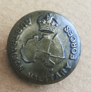
No marker’s mark. Possibly British.
The AMF uniform button was designed in 1912 and used until until the Coronation of Queen Elizabeth in 1953. They were designed with and without state borderson the map. One strange version has the border between South Australia and the Northern Territory missing. This was not necessarily an error: South Australia was only separated from the Northern Territory on 1st January 1911. At the start of WW1 with a sudden large demand for uniforms, many manufacturers in both Britain and Australia started producing buttons. Perhaps an unknown British manufacturer based their die on an out-of-date map?
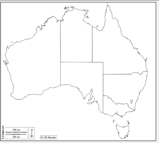
Some of the Australian maps were pretty ‘wonky’! Below is what the map should look like:
As you can see on the above button, the die-sinker has rounded off the south-west corner of West Australia, but included the small promontories that jut out into the Indian ocean.
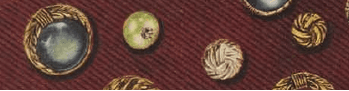
Some buttons have a smoothly curved WA coastline, or a strangely bugling one. The two gulfs on either side of Arnhem Land vary in size and shape, as does Arnhem Land. Cape York Peninsula is sometime surprisingly long and pointy. Tasmania is sometimes triangular, sometimes round. Bass Strait almost disappears on some. Some make a brave attempt at the two gulfs on South Australia’s coast, others only one, and some leave them out altogether.
It is hard to be sure whether an AMF button dates from WW1 or WW2 as example with/without state borders were used for both; except some later versions with borders have a small dot locating the ACT within NSW. Australian backmarks can help. See the ‘Federation-WW2’ and the ‘WW2 onwards’ pages.
It can be a challenge to collect all the variations of backmarks and map shapes of this one single uniform button. For the rest of my collection, see http://www.austbuttonhistory.com/defence-forces-uniform-buttons/1901-ww2/#Australian_Commonwealth_Military_Forces_1903-1916.
For all comments or queries, please use the Contact page.